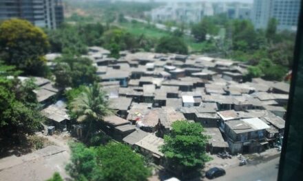


Map of all containment areas in Mumbai made public by BMC
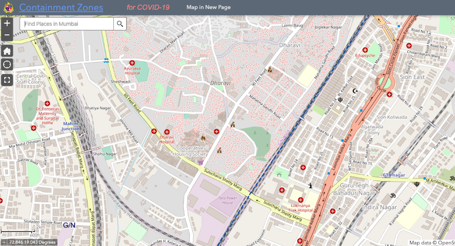
The BMC has made public the Geographic Information System (GIS) map of COVID-19 affected and containment areas in the city on its website (screengrab from BMC’s website)
The BMC has made public the Geographic Information System (GIS) map of coronavirus affected and containment areas in the city on its website on Thursday.
Earlier this week, the BMC had announced the GIS mapping of COVID-19-affected areas in the city, besides setting set up a ‘war room’ to monitor the viral infection in the city.
The civic body had said that with the help of the maps, residents in those areas could take precautions more vigilantly, and people visiting those places for any work could take preventive measures.
The maps of the areas where there are higher number of coronavirus cases will be posted on the BMC website to provide information about it to the public, civic chief Praveen Pardeshi had said in a release.
A BMC spokesperson said that the citizens can check these coronavirus-affected areas from the civic body’s website. The exact link for the GIS map is here.
The BMC has also formed a ‘corona war room’ in its disaster control unit, which will be functional round-the-clock. Various activities like planning, prevention, and management of the pandemic will be conducted there.
Maharashtra Chief Minister Uddhav Thackeray has sent two senior IAS officers – Ashwini Bhide and Dr. Ramaswamy N – on deputation to the BMC to take steps to contain the spread of the deadly disease in the country’s financial capital.
To date, the BMC has demarcated at least 193 containment zones across the city to avoid the spread of coronavirus.
Maharashtra, meanwhile, has witnessed 340 confirmed coronavirus cases and 13 related deaths as of Thursday morning.