ISRO successfully launches 7th satellite, India becomes 6th country to have it’s own navigation system


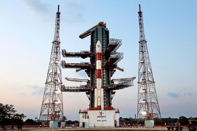
The IRNSS-1G gearing up for launch
On Thursday, Indian Space Research Organisation (ISRO) successfully launched its seventh navigation satellite to accomplish the goal of building the nation’s very own navigation system.
The satellite, named IRNSS-1G (Indian Regional Navigation Satellite System), was carried by Polar Satellite Launch Vehicle (PSLV) C33 and lifted off from the first launch pad at the Satish Dhawan Space Centre in Sriharikota at 12.50 pm.
Around 1:10 pm, the PSLV-C33 successfully placed IRNSS-1G in orbit at an altitude of 497.8 km. The satellite, weighing 1,425 kg, has a 12-year mission life.
The launch of IRNSS-1G completes the Indian Regional Navigation Satellite System (IRNSS), thereby reducing the nation’s dependence on the US Global Positioning System. In 1999, US had denied GPS information to India during the Kargil war, which created an urgent ‘need’ for developing the country’s very own indigenous navigation system.
Over the next three to six months, the seventh satellite will be aligned with the others. When the constellation is formed, the IRNSS will serve as a 24/7 standard service for air, sea, ship transport among others. The system will also be useful for military and missile-related applications such as encrypted and restricted service.
Prior to the IRNSS-1G, ISRO had launched IRNSS-1A on July 1, 2013 followed by IRNSS-1B (April 4, 2014), IRNSS-1C (October 16, 2014), IRNSS-1D (March 28, 2015), IRNSS-1E (January 20, 2016) and IRNSS-1F (March 10, 2016). ISRO has spent approximately Rs 1,420 crore on the seven satellites.
With the launch, India joins the elite list of nations like US, Russia, China and European Union who have their very own navigation system.
You can watch the IRNSS-1G launch here:


